
![]()
![]()
![]()
![]()
Distanza: 26 Km circa
Dislivello: 500 metri
Percorrenza: 2 H. circa
Consigliato: per tutti
Vedi mappa: www.gpsies.com
Descrizione:
The itinerary is easily downloadable on your phone with the GPS feature guides you on the route.
The path, in the initial section, winds along the slopes, in the middle of the vineyards. After three kilometers we find the village of Rolle.
A short break to enjoy the panorama that opens in front of us.
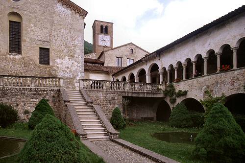
We reach Follina, where we can admire the 12th Cistercian abbey.
The view of the impressive CastelBrando anticipates the arrival at Cison di Valmarino.
When we leave the village we get a stadina leading us to the plain where Soligo flows.
We walk across the “valley” to Tarzo, passing through Fratta (see the many murals).
From Tarzo begins the ascent to Arfanta.


