Prenota

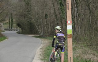
LE CRESTE DEL MONDRAGON E DEL COL FRANCHIN

Distanza: 19 Km Dislivello: 600 metri Percorrenza: 2 H in bicicletta , 5 H a piedi. Consigliato: mtb, camminata. Vedi mappa: www.gpsies.com Descrizione: The itinerary is easily downloadable on your phone with the GPS feature guides you on the route. [...continua]

The villages and the history

Distanza: 26 Km circa Dislivello: 500 metri Percorrenza: 2 H. circa Consigliato: per tutti Vedi mappa: www.gpsies.com Descrizione: The itinerary is easily downloadable on your phone with the GPS feature guides you on the route. The path, in the initial section, winds along the [...continua]