Prenota

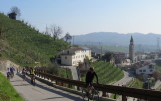
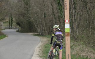
Vittorio Veneto – Arfanta per la “via Maestra”

Distanza: 14 Km Dislivello: 400 metri Percorrenza: 4 H. Consigliato: camminata - MTB. Vedi mappa: www.gpsies.com Descrizione: L’itinerario è facilmente scaricabile sul vostro telefono che con la funzione GPS vi guida sul percorso A lunch on a farm with a nice walk to go hungry? The [...continua]

LE RIVE DI S.PIETRO E LA COSTA DI ZUEL

Distanza: 17 Km Dislivello: 400 metri Percorrenza: 1.5 H. Consigliato: mtb. Vedi mappa: www.gpsies.com Descrizione: From the farmhouse, head to Arfanta and just past the Tulio Hotel turn left for a side (white and red sign). You will pass the [...continua]

LE CRESTE DEL MONDRAGON E DEL COL FRANCHIN

Distanza: 19 Km Dislivello: 600 metri Percorrenza: 2 H in bicicletta , 5 H a piedi. Consigliato: mtb, camminata. Vedi mappa: www.gpsies.com Descrizione: The itinerary is easily downloadable on your phone with the GPS feature guides you on the route. [...continua]

Il CASIN DEI OCHET (bivacco Marsini)

Distanza: 7 Km Dislivello: 300 metri Percorrenza: 2 H a piedi , 1 H in MTB. Consigliato: camminata, MTB. Vedi mappa: www.gpsies.com Descrizione: Ring route starting from the farm. The itinerary is easily downloadable on your phone with the GPS [...continua]

The villages and the history

Distanza: 26 Km circa Dislivello: 500 metri Percorrenza: 2 H. circa Consigliato: per tutti Vedi mappa: www.gpsies.com Descrizione: The itinerary is easily downloadable on your phone with the GPS feature guides you on the route. The path, in the initial section, winds along the [...continua]